Parrot's Drumble
| Parrot's Drumble | |
|---|---|
 The stream coloured by iron oxide from old mineworkings | |
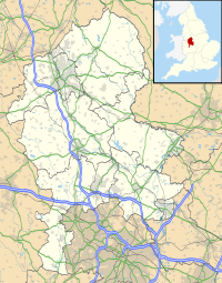
| Location | Talke Pits, Staffordshire |
| OS grid | SJ 818 522 |
| Coordinates | 53°4′0″N 2°16′23″W / 53.06667°N 2.27306°W |
| Area | 12 hectares (30 acres) |
| Operated by | Staffordshire Wildlife Trust |
| Website | www |
Parrot's Drumble is a nature reserve of the Staffordshire Wildlife Trust. It is an area of woodland next to the village of Talke Pits, and about 4 miles (6.4 km) north of Newcastle-under-Lyme, in Staffordshire, England.
Description
[edit]Its area is 12 hectares (30 acres). It is an ancient woodland, the area having been woodland for more than 400 years. It was once owned by a family named Parrot, and a "drumble" is a local word for a stream running through a wooded valley.[1]
There are old mineworkings in the area, from which iron oxide leaches, giving the stream a reddish colour.[1]
There is a walking trail through the wood, where there is oak, hazel, birch, rowan and ash; near the stream there is willow and alder. Woodland plants include dog's mercury, yellow archangel and wood-sorrel, and in the spring there are notable displays of bluebells. Birds to be seen include great spotted woodpecker, lesser spotted woodpecker, nuthatch and treecreeper.[1]
Parrots Drumble is the source of the River Waldron which flows through Staffordshire and Cheshire until it meets the River Weaver near Nantwich.
References
[edit]- ^ a b c "Parrot's Drumble" Staffordshire Wildlife Trust. Retrieved 11 February 2021.

